Directions to Our Church
Click here for a Google Map.
Coming from I-75
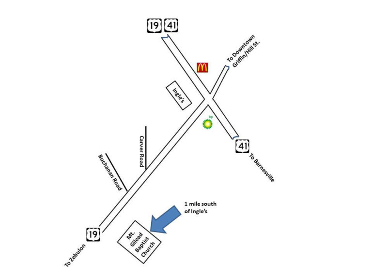
Take Exit 205 and go West on Highway 16 to downtown Griffin. Turn left on Highway 155 and go approximately 4 miles to the intersection of Highways 19 & 41. Go straight through the signal while remaining on Highway 19 South. Go approximately 1.3 miles from that intersection and the church is located on the left.
Coming from north of Griffin (Griffin Wal-Mart)
Take the Highway 19/41 South bypass for approximately 5 miles to the intersection of Highways 19 & 41. Take a right at the Ingle’s Supermarket and continue South on Highway 19 toward Zebulon. Go approximately 1.3 miles from that intersection and the church is located on the left.
Coming from south of Griffin (Barnesville)
Take Highway 41 North toward Griffin. At the intersection of Highways 19 & 41 turn left onto Highway 19 South toward Zebulon. Go approximately 1.3 miles from that intersection and the church is located on the left.
Coming from south of Griffin (Zebulon/Thomaston)
Take Highway 19 North towards Griffin. Approximately 21 miles from Thomaston and 8 miles from Zebulon, the church will be located on the right.
Using your GPS.
If you decide to use your GPS to locate our church, be aware that the names of the roads near our church have been changed and many GPS maps have not been updated. Most GPS devices locate us more accurately using this address: 3500 Zebulon Rd. Griffin, Georgia 30224.


